To print the map using your web browser, the print functions default to the browsers print capabilities. Typically, print functions allow users to create a PDF document, or print to a networked printer of the user’s choice. To use the Print tool, specify the following parameters and click the Print button:
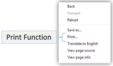
Go to the browser window that contains the content you would like to print. Right click your mouse in the browser window and click on “Print…”(see Figure 17)
Figure 17: Print Button
OR
Press both the Ctrl and the P button on your keyboard at the same time as a short-cut or go “File” on the top menu of your browser, and select “Print…” from the drop-down menu. The “Print” dialog window will appear.
Once this window opens, if you would like to change any setting or change the number of copies you would like to print, please do so now and then click the Apply button (if it is not “grayed” out).
Now, click the Print button to print the current active screen on your desktop
Internet Explorer:
The Print Map button creates a PDF document of the current map extent with parameters set by the user. To use the Print tool, specify the following parameters and click the Print button.
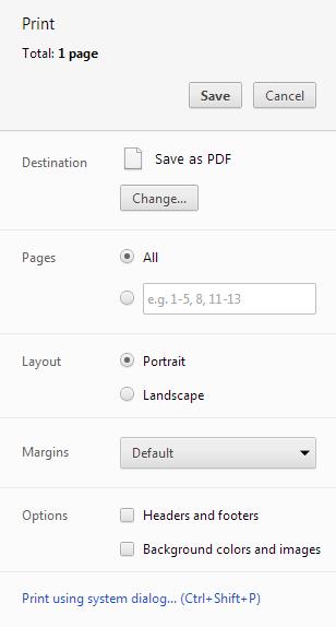
Google Chrome:
To print the webpage you’re viewing in Chrome, press CTRL+P (Mac: ⌘-P). You’ll be able to preview the page and adjust basic printer and page settings, before printing.
Figure 18: Print configuration